
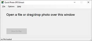
Quick Photo GPS Extract is a very small software tool that allows you to view the GPS coordinates of a photo on Google Maps in your standard web browser. For some people this program can be an alternative to the full Photo GPS Extract program, which is currently no longer available for download.
Quick Photo GPS Extract can be used in multiple ways:
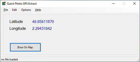
Quick Photo GPS Extract will then launch a new webpage with a Google Maps in your standard web browser (Edge, Chrome, Firefox, ...), with the Google map pointing to the given coordinates. Since the program just launches the standard browser, it doesn't suffer from compatibility and Google Maps licensing issues. The software is very useful for people that occasionally wants to visualize the location of a single photo.
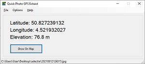
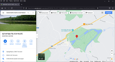
!!! Please note the browser will only show the position of your photo. You won't see a preview of your own photo. For some locations the Google Maps might show you a Google StreetView image for the given location. This is the case in the screenshot above.
Version 1.3 of the program now also contains a coordinate decoder. You can copy & paste some coordinates from any software, and decode the coordinates to numeric degrees. Once you decoded the coordinates you can show them on the Google Maps, or convert and copy them to another format.
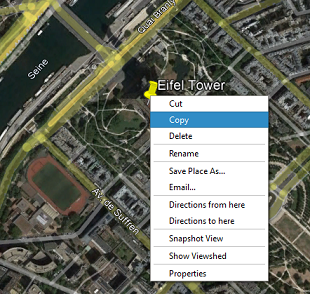
The coordinate decoder also allows you to copy & paste a PlaceMark from the Google Earth desktop application.
The following images illustrate how you can right-click a PlaceMark to copy it, and paste it into the Quick Photo GPS Extract program (Edit → Paste). Once you have the coordinates you can also open them in a regular Goolge Maps, or copy the coordinates to the desired format.
The coordinate decoder can decode a lot of different GPS formats. Some examples:
You can download a fully functional version of the program. The download contains just an .exe executable file that can be placed anywhere on your computer. If there is much interest in this software, I will also create a setup wizard to install the program properly.
One word of caution: to be able to right click a photo in your Windows Explorer, you must enable the shell integration. This can be done in the menu "Options → Enable Windows Shell Integration". In case you decide to delete the program from your computer, I recommend to disable this option first. Otherwise, your Windows will keep showing this option when right clicking JPG images...
Please note this software does not have a digital signature. Digital signatures help to verify the developer of software, and allow you to verify the software was not modified. As a small freeware developer I cannot get such digital certificates.
MD5 checksum: 2f463d4f1f3d8130d4601ff7baf054f8
This program is freeware and can be used for both private or professional use. The program does not collect your data in any way. It only reads the GPS Latitude, GPS Longitude and GPS Elevation from the given pictures and opens a Google Maps for these coordinates. This is done by passing both GPS Latitude and Longitude as URL parameters to the site. Only Google can see the coordinates you specified.
Please check out the Google Terms of use and the Google Privacy statements for more information (you can find them at the bottom of the Google Maps page).
Please do not hesitate to contact me if you have any problems or questions. You can contact me by E-mail.